Blairite millionaires, politicians and media tycoons are reportedly plotting to stop Brexit in its tracks, a leaked memo suggests. Virgin Group chief Sir Richard Branson is apparently bankrolling the scheme. No doubt the dire position UK’s Labour Party is in has created a vacuum in which this Resurrection can take place, however once again Blair will..
Continue reading…
The 1% plotting to halt BRexit & resurrect Blair and recapture Britain for the Supremacists
Posted on Leave a comment

Trump and BRexit leaves World Supremacists Obama, Merkel, Hollande and EU panicking on the wrong side of History
Posted on 3 Comments
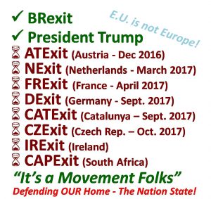
The Donald Trump and earlier BRexit victories have left World Supremacists like Obama, Merkel, Hollande and EU shocked and panicking on the wrong side of History. Never before have the ruling Elite and Media been so out of touch! The Political Establishment in Washington and Europe are in shock over Donald Trump’s US presidential win…
Continue reading…
Dictator Hollande Says NO to French #FRexit Referendum. Democracy being tested by BRexit win, and failing.
Posted on 2 Comments

Dictator Hollande Has Denied France a referendum for FRexit. Democracy is being tested by BRexit win throughout Europe and US even. Francois Hollande has firmly rejected calls for a referendum on leaving the EU, said French nationalist leader Marine Le Pen. Disappointed with the talks and disregard for public opinion, she was left with the “feeling..
Continue reading…