Doctors without Borders (MSF) is under investigation over allegations it facilitates illegal immigration as debate rages in Italy following accusations, backed by the government, that it and other NGOs are colluding with people smugglers in Libya. Italian newspaper Corriere della Sera reported that Italian prosecutors have begun investigating MSF for rescuing migrants stranded at sea..
Continue reading…
Doctors Without Borders and other NGOs under investigation for collusion with Human Traffickers in The Med
Posted on Leave a comment
Traitorous Migrant “Rescue” NGOs 100% in Cahoots with Human Traffickers & Smugglers – Italian Minister
Posted on 2 Comments
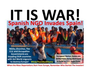
The Italian Foreign Minister has publicly agreed ‘100 percent’ that migrant NGOs are working with people traffickers to smuggle Africans into Europe. Italian Foreign Minister Angelino Alfano has come out and said that he “agreed 100 percent” with claims made last week accusing african migrant rescue charities of colluding with people smugglers and traffickers in..
Continue reading…
Traitorous NGOs learn Africans will kill you to get to Free Stuff in Europe. Send out SOS after taking on too many invaders in the Med.
Posted on Leave a comment
A transport vessel collecting African migrants in the Mediterranean Sea has issued a mayday distress call due to overcrowding on the boat, as the traitors struggle to handle this weekend’s unprecedented flow of people in such a short space of time. Putting money before patriotism, Jugend Rettet has called for “urgent help” to come to..
Continue reading…